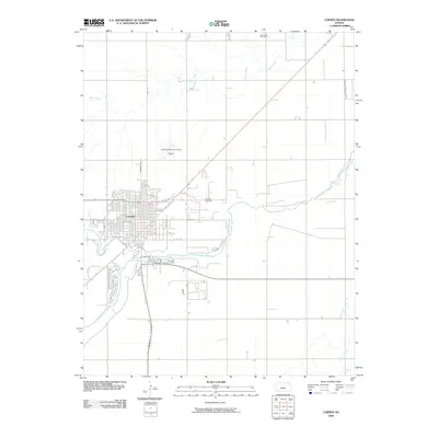
2009 Map of Larned
USGS Topo · Published 2009About this map
Larned stands at the strategic confluence of the Pawnee River and the Arkansas River, serving as a central hub for Pawnee County. The town's grid is well-established, reaching from Broadway Ave out to residential streets like Anne St and Deanne St. The surrounding landscape is defined by the intersection of water and industry, with several major creeks such as Ash Creek and Pickle Creek meandering through the prairie.
Find a feature on this map
24 named features on this map. Tap any name to fly to it.
Don’t see what you’re looking for? This feature index may not catch every label — zoom into the map to look around manually.
Map Details
Editions of this 2009 Larned Map
This is the sole edition of this map. No revisions or reprints were ever made.
Other maps of this area

1889 · Larned
USGS Topo · 1:125,000

1891 · Great Bend
USGS Topo · 1:125,000

1891 · Larned
USGS Topo · 1:125,000

1893 · Great Bend
USGS Topo · 1:125,000

1955 · Great Bend
USGS Topo · 1:250,000

1957 · Great Bend
USGS Topo · 1:250,000

1958 · Great Bend
USGS Topo · 1:250,000

1960 · Pawnee Rock
USGS Topo · 1:24,000
1969 · Radium
USGS Topo · 1:24,000

1970 · Fort Larned
USGS Topo · 1:24,000