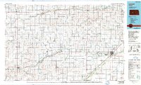
1985 Map of Larned
USGS Topo · Published 1990About this map
Fort Larned National Historic Site stands as a focal point in this portion of western Kansas, where the high plains transition into the valley systems of the Arkansas River and the Pawnee River. This mid-1980s landscape reveals a grid-aligned agricultural economy supported by an extensive network of small grain-shipping towns along the Atchison Topeka and Santa Fe Railway and the Missouri Pacific Railroad. Beyond the municipal centers of Larned and Ness City, the map details a rural infrastructure of named townships like Alexander-Belle Prairie and Browns Grove. The terrain is marked by numerous Oil and Gas Fields, particularly in the northern reaches near Nekoma and Bazine, while the Hodgeman County State Fishing Lake and Wildlife Area provides a rare concentrated water resource in the western uplands.
Find a feature on this map
76 named features on this map. Tap any name to fly to it.
Don’t see what you’re looking for? This feature index may not catch every label — zoom into the map to look around manually.
Map Details
Editions of this 1985 Larned Map
2 editions found
Other maps of this area

1889 · Larned
USGS Topo · 1:125,000

1889 · Kinsley
USGS Topo · 1:125,000

1891 · Great Bend
USGS Topo · 1:125,000

1891 · Larned
USGS Topo · 1:125,000

1892 · Ness
USGS Topo · 1:125,000

1892 · Kinsley
USGS Topo · 1:125,000

1892 · Dodge
USGS Topo · 1:125,000

1892 · Spearville
USGS Topo · 1:125,000

1892 · Pratt
USGS Topo · 1:125,000

1893 · Ellis
USGS Topo · 1:125,000