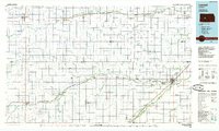
1985 Map of Larned
USGS Topo · Published 1985About this map
Fort Larned National Historic Site stands as a central landmark in this mid-1980s look at central Kansas, where the Arkansas River and Pawnee River converge. This region, spanning several counties including Pawnee, Ness, and Hodgeman, is defined by its agricultural grid and the steady path of the Atchison Topeka and Santa Fe railroad line. The map captures established western towns like Ness City and Larned, alongside smaller rail-aligned communities such as Rozel, Burdett, and Rush Center.
Find a feature on this map
53 named features on this map. Tap any name to fly to it.
Don’t see what you’re looking for? This feature index may not catch every label — zoom into the map to look around manually.
Map Details
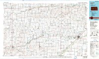
Editions of this 1985 Larned Map
2 editions found
Other maps of this area

1889 · Larned
USGS Topo · 1:125,000

1889 · Kinsley
USGS Topo · 1:125,000

1891 · Great Bend
USGS Topo · 1:125,000

1891 · Larned
USGS Topo · 1:125,000

1892 · Ness
USGS Topo · 1:125,000

1892 · Kinsley
USGS Topo · 1:125,000

1892 · Dodge
USGS Topo · 1:125,000

1892 · Spearville
USGS Topo · 1:125,000

1892 · Pratt
USGS Topo · 1:125,000

1893 · Ellis
USGS Topo · 1:125,000