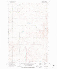
1973 Map of Larslan
USGS Topo · Published 1976About this map
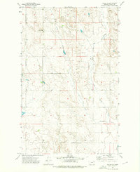
Larslan serves as the central hub of this northern Valley County landscape, situated within the northern reaches of the Fort Peck Indian Reservation. The map depicts an environment defined by the dendritic drainage patterns of the East Fork Porcupine Creek and its various tributaries, including Snow Coulee and West Fork Little Porcupine Creek. Evidence of local infrastructure and land use is present through features such as the Landing Strip, a remote Well, and Gravel Pits, suggesting a reliance on aviation and resource extraction in this sparsely populated region. Further south, the Hovland Dam manages local water flow, while a small Cem stands as a quiet marker of the community's local history. The land's character is shaped by its transition between prairie and the coulees that feed the larger Porcupine Creek system.
Find a feature on this map
15 named features on this map. Tap any name to fly to it.
Don’t see what you’re looking for? This feature index may not catch every label — zoom into the map to look around manually.
Map Details
Editions of this 1973 Larslan Map
This is the sole edition of this map. No revisions or reprints were ever made.
Other maps of this area

1915 · Spring Creek
USGS Topo · 1:62,500
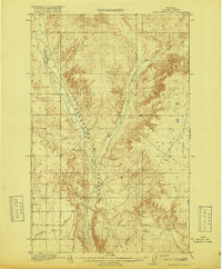
1918 · Porcupine Valley
USGS Topo · 1:62,500

1954 · Glasgow
USGS Topo · 1:250,000

1957 · Glasgow
USGS Topo · 1:250,000

1958 · Glasgow
USGS Topo · 1:250,000
1973 · Baylor SE
USGS Topo · 1:24,000
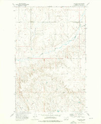
1973 · Larslan NW
USGS Topo · 1:24,000
1973 · Baylor NE
USGS Topo · 1:24,000
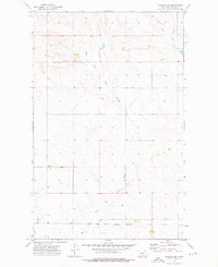
1973 · Johnnys Hill
USGS Topo · 1:24,000
1973 · Blink Springs
USGS Topo · 1:24,000