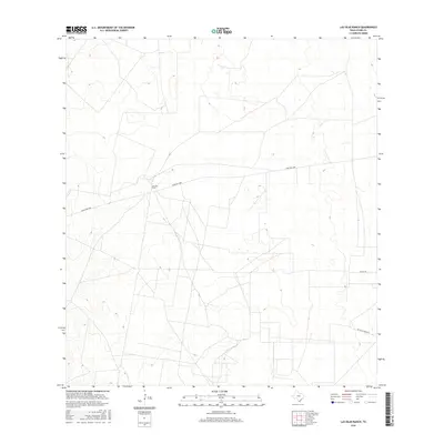
2016 Map of Las Islas Ranch
USGS Topo · Published 2016About this map
Las Islas Ranch serves as the primary landmark in this ranchland region of Starr County. The landscape is characterized by a network of rural routes, including Ranch Rd 2686, which traverses the central portion of the map. Smaller, named arteries like Alaniz Rd and San Blas Ranch Rd branch off to reach localized property holdings. The sparse distribution of named features reflects the expansive, open nature of this South Texas territory, where named ranches often stand as the central identifiers for large tracts of land. This map provides a detailed view of the infrastructure and elevation of these rural holdings in the mid-2010s, capturing the specific parcel divisions and road networks that connect them.
Find a feature on this map
4 named features on this map. Tap any name to fly to it.
Don’t see what you’re looking for? This feature index may not catch every label — zoom into the map to look around manually.
Map Details
Editions of this 2016 Las Islas Ranch Map
This is the sole edition of this map. No revisions or reprints were ever made.
Other maps of this area

1938 · El Sauz
USGS Topo · 1:62,500

1938 · Agua Nueva
USGS Topo · 1:62,500

1938 · Sal Colorada
USGS Topo · 1:62,500

1938 · Cuevitas
USGS Topo · 1:62,500

1949 · Mc Allen
USGS Topo · 1:250,000

1954 · McAllen
USGS Topo · 1:250,000

1957 · Mc Allen
USGS Topo · 1:250,000

1962 · McAllen
USGS Topo · 1:250,000

1972 · Cuevitas
USGS Topo · 1:24,000
1972 · Viboras
USGS Topo · 1:24,000