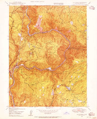
1948 Map of Las Plumas
USGS Topo · Published 1955About this map
Lassen Mountain and the deep canyons of the North Fork Feather River dominate this 1948 landscape, capturing a moment of industrial activity and mountain settlement within the Plumas National Forest. The Western Pacific railroad tracks hug the river's contours, serving remote outposts like Las Plumas and Berry Creek Station. The presence of the Diversion Dam, a Tram, and a Powerhouse near Island Bar reflects the river's development for utility during this era.
Find a feature on this map
56 named features on this map. Tap any name to fly to it.
Don’t see what you’re looking for? This feature index may not catch every label — zoom into the map to look around manually.
Map Details
Editions of this 1948 Las Plumas Map
This is the sole edition of this map. No revisions or reprints were ever made.
Other maps of this area

1888 · Bidwell Bar
USGS Topo · 1:125,000

1891 · Bidwell Bar
USGS Topo · 1:125,000

1891 · Chico
USGS Topo · 1:125,000

1893 · Chico
USGS Topo · 1:125,000

1893 · Bidwell Bar
USGS Topo · 1:125,000

1895 · Bidwell Bar
USGS Topo · 1:125,000

1895 · Chico
USGS Topo · 1:125,000

1897 · Bidwell Bar
USGS Topo · 1:125,000

1912 · Oroville
USGS Topo · 1:31,680

1942 · Oroville
USGS Topo · 1:62,500