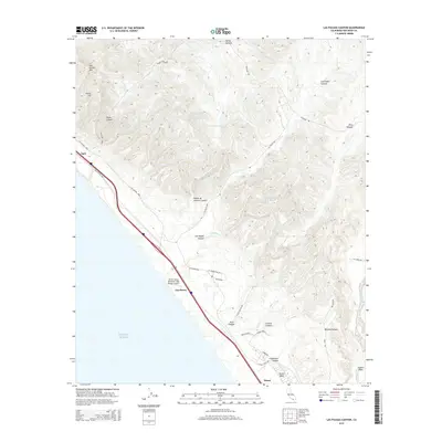
2015 Map of Las Pulgas Canyon
USGS Topo · Published 2015About this map
Las Flores sits at the intersection of California’s coastal transit corridors and the expansive training grounds of Marine Corps Base Camp Pendleton. This 2015 survey illustrates the modern strategic landscape, centered on the MCOLF Camp Pendleton (Red Beach) Airport and the surrounding rugged canyons including Las Pulgas Canyon and French Canyon. The map details the transition from the Pacific Ocean shoreline across the historic route of El Camino Real into the rising elevations of the Santa Margarita Mountains. Notable terrain features like San Onofre Mtn and Horno Hill dominate the northwestern quadrant, while the southern reaches descend toward the Ysidora Basin. The drainage patterns of Las Flores Cr and the presence of Pulgas Lake highlight the hydrology of this protected coastal interior, managed for decades as a military reservation which has preserved its topographical character from more typical suburban development.
Find a feature on this map
37 named features on this map. Tap any name to fly to it.
Don’t see what you’re looking for? This feature index may not catch every label — zoom into the map to look around manually.
Map Details
Editions of this 2015 Las Pulgas Canyon Map
This is the sole edition of this map. No revisions or reprints were ever made.
Other maps of this area

1893 · Oceanside
USGS Topo · 1:62,500

1898 · Oceanside
USGS Topo · 1:62,500

1901 · Oceanside
USGS Topo · 1:62,500

1901 · San Luis Rey
USGS Topo · 1:125,000

1902 · Capistrano
USGS Topo · 1:125,000

1904 · Southern California Sheet No. 2
USGS Topo · 1:250,000

1906 · Capistrano
USGS Topo · 1:125,000

1941 · Margarita Peak
USGS Topo · 1:62,500

1942 · Margarita Peak
USGS Topo · 1:62,500

1942 · San Juan Capistrano
USGS Topo · 1:62,500
Featured Places
- Las Flores, Marine Corps Base Camp Pendleton
- Marine Corps Base Camp Pendleton, CA
- San Diego County, CA
- United States
- California