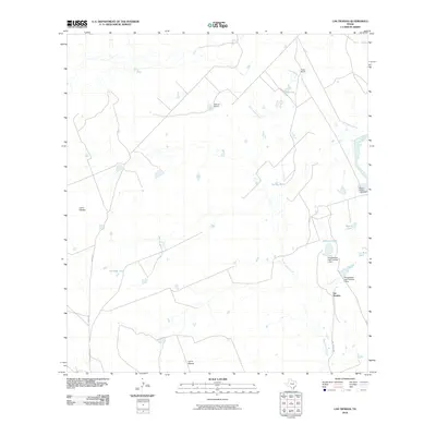
2010 Map of Las Tiendas
USGS Topo · Published 2010About this map
Las Tiendas serves as the focal point for this ranching landscape in Webb County, where a network of private estates and water management systems defines the local geography. The map documents a semi-arid terrain shaped by the drainages of Santa Isabel Creek and Cochio Creek. Ranching operations are clearly marked by named holdings such as Fuller Ranch, Hearne Ranch, and Spohn Ranch, reflecting the long-standing land-use patterns of South Texas. A sophisticated system of livestock water sources is evident through numerous named reservoirs, including Cascavel Tank, Tapon Tank, and Jefferies Tank, as well as engineered structures like Chupahueso Lake Number 1 Dam. Local topography is highlighted by distinct rises such as Loma Caliche and Loma Blanca, which provide relief in this brush-country environment. The sparse road network, featuring Las Tiendas Rd and Miles Rd, underscores the rural and expansive nature of these large land tracts.
Find a feature on this map
19 named features on this map. Tap any name to fly to it.
Don’t see what you’re looking for? This feature index may not catch every label — zoom into the map to look around manually.
Map Details
Editions of this 2010 Las Tiendas Map
This is the sole edition of this map. No revisions or reprints were ever made.
Other maps of this area

1923 · Palafox
USGS Topo · 1:62,500

1929 · Cotulla
USGS Topo · 1:125,000

1940 · Velenzuela Creek
USGS Topo · 1:62,500

1940 · San Loranzo Creek
USGS Topo · 1:62,500

1953 · Crystal City
USGS Topo · 1:250,000

1955 · Crystal City
USGS Topo · 1:250,000

1956 · Las Tiendas
USGS Topo · 1:62,500

1956 · Laredo
USGS Topo · 1:250,000

1961 · Crystal City
USGS Topo · 1:250,000

1965 · Spohn Ranch
USGS Topo · 1:24,000