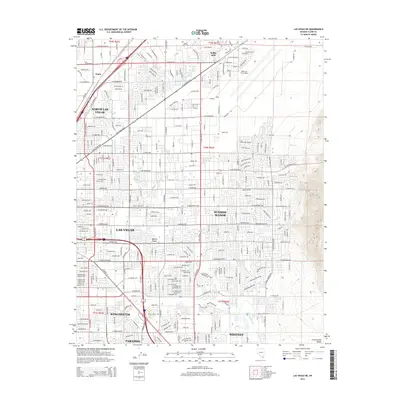
2014 Map of Las Vegas NE
USGS Topo · Published 2014About this map
Nellis Air Force Base dominates the northeastern corner of this urban Nevada landscape, serving as a significant military anchor for the surrounding communities. The dense residential and commercial expansion of North Las Vegas and Sunrise Manor is clearly documented, illustrating the intense development of the Mojave Desert floor. Major thoroughfares like Boulder Hwy and N Las Vegas Blvd connect the primary districts of Las Vegas, Winchester, and Paradise, defining the transportation grid that fuels the region's economy. Along the eastern edge, the topography shifts abruptly at the foot of the Frenchman Range, where the natural drainage of the Las Vegas Wash meanders southward toward Whitney. This survey provides a precise look at the suburban infill between established neighborhoods like Three Crowns and the outlying rail siding area at Wann.
Find a feature on this map
49 named features on this map. Tap any name to fly to it.
Don’t see what you’re looking for? This feature index may not catch every label — zoom into the map to look around manually.
Map Details
Editions of this 2014 Las Vegas NE Map
This is the sole edition of this map. No revisions or reprints were ever made.
Other maps of this area

1886 · Saint Thomas
USGS Topo · 1:250,000

1893 · Saint Thomas
USGS Topo · 1:250,000

1907 · Las Vegas
USGS Topo · 1:250,000

1908 · Las Vegas
USGS Topo · 1:250,000

1926 · Boulder Canyon
USGS Topo · 1:96,000

1952 · Gass Peak
USGS Topo · 1:62,500

1952 · Dry Lake
USGS Topo · 1:62,500

1952 · Henderson
USGS Topo · 1:62,500

1952 · Las Vegas
USGS Topo · 1:62,500

1954 · Las Vegas
USGS Topo · 1:250,000