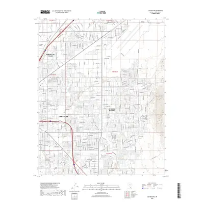
2018 Map of Las Vegas NE
USGS Topo · Published 2018About this map
Las Vegas and North Las Vegas appear at a period of significant urban density on the floor of the Las Vegas Valley. This map illustrates the intersection of sprawling residential development with major military and industrial infrastructure. The northeastern portion of the sheet is dominated by the extensive grounds of Nellis Air Force Base, while the Union Pacific RR cuts through the western industrial corridors. The transition from the built environment to the natural landscape is sharp, defined by the rising contours of the Frenchman Range to the east and the open Mojave Desert terrain. Local institutional growth is marked by sites like the Nevada Career Institute, and the hydrologic character of the basin is traced via the Las Vegas Wash, which winds through the residential blocks of Sunrise Manor.
Find a feature on this map
159 named features on this map. Tap any name to fly to it.
Don’t see what you’re looking for? This feature index may not catch every label — zoom into the map to look around manually.
Map Details
Editions of this 2018 Las Vegas NE Map
This is the sole edition of this map. No revisions or reprints were ever made.
Other maps of this area

1886 · Saint Thomas
USGS Topo · 1:250,000

1893 · Saint Thomas
USGS Topo · 1:250,000

1907 · Las Vegas
USGS Topo · 1:250,000

1908 · Las Vegas
USGS Topo · 1:250,000

1926 · Boulder Canyon
USGS Topo · 1:96,000

1952 · Gass Peak
USGS Topo · 1:62,500

1952 · Dry Lake
USGS Topo · 1:62,500

1952 · Henderson
USGS Topo · 1:62,500

1952 · Las Vegas
USGS Topo · 1:62,500

1954 · Las Vegas
USGS Topo · 1:250,000