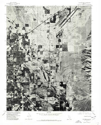
1973 Map of Las Vegas NE
USGS Topo · Published 1977About this map
Nellis Air Force Base dominates the northeastern landscape of this 1973 orthophotograph, its runways and taxiways appearing as sharp geometric signatures against the Mojave desert. This aerial perspective, captured just before the explosive suburban expansion of the late 20th century, reveals the emerging grid of North Las Vegas as it pushes against the open desert. To the south, the early urban footprint of Las Vegas begins to coalesce, separated from the arid highlands by the distinct drainage path of the Las Vegas Wash. Unlike a traditional topographic map, this photographic survey provides a literal view of land use during the early 1970s, showing the precise density of residential blocks, the industrial corridors of the military installation, and the stark contrast between the irrigated valley floor and the surrounding desert scrub.
Find a feature on this map
4 named features on this map. Tap any name to fly to it.
Don’t see what you’re looking for? This feature index may not catch every label — zoom into the map to look around manually.
Map Details
Editions of this 1973 Las Vegas NE Map
This is the sole edition of this map. No revisions or reprints were ever made.
Other maps of this area

1886 · Saint Thomas
USGS Topo · 1:250,000

1893 · Saint Thomas
USGS Topo · 1:250,000

1907 · Las Vegas
USGS Topo · 1:250,000

1908 · Las Vegas
USGS Topo · 1:250,000

1926 · Boulder Canyon
USGS Topo · 1:96,000

1952 · Gass Peak
USGS Topo · 1:62,500

1952 · Dry Lake
USGS Topo · 1:62,500

1952 · Henderson
USGS Topo · 1:62,500

1952 · Las Vegas
USGS Topo · 1:62,500

1954 · Las Vegas
USGS Topo · 1:250,000