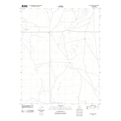
2010 Map of Las Vegas SE
USGS Topo · Published 2010About this map
Leatherwood Ranch and Lewis Ranch anchor the northern landscape of this San Miguel County territory at the start of the twenty-first century. The terrain is defined by the high-plains ranching economy, where wide-open grazing land is punctuated by drainage systems like Rito Vegoso and the winding course of Canon del Agua. This 2010 survey illustrates the modern layout of rural landholdings, showing the spatial relationship between isolated homesteads such as Spurlock Ranch and Belden Ranch. The network of local and state roads crossing this landscape highlights the continued importance of these historical ranching outposts in northeastern New Mexico, providing a clear record of property locations and natural hydrology before further regional development.
Find a feature on this map
6 named features on this map. Tap any name to fly to it.
Don’t see what you’re looking for? This feature index may not catch every label — zoom into the map to look around manually.
Map Details
Editions of this 2010 Las Vegas SE Map
This is the sole edition of this map. No revisions or reprints were ever made.
Other maps of this area

1889 · Las Vegas
USGS Topo · 1:125,000

1890 · Bernal
USGS Topo · 1:125,000

1891 · Bernal
USGS Topo · 1:125,000

1891 · Las Vegas
USGS Topo · 1:125,000

1892 · Watrous
USGS Topo · 1:125,000

1892 · Corazon
USGS Topo · 1:125,000

1893 · Las Vegas
USGS Topo · 1:125,000

1894 · Corazon
USGS Topo · 1:125,000

1894 · Watrous
USGS Topo · 1:125,000

1894 · Bernal
USGS Topo · 1:125,000