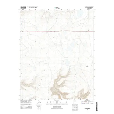
2013 Map of Las Vegas SE
USGS Topo · Published 2013About this map
Leatherwood Ranch and Lewis Ranch anchor the northern landscape of this San Miguel County territory, where the terrain transitions from high plateaus into the dramatic relief of Cañon del Agua. The map reveals a land defined by dispersed family ranching operations, including Spurlock Ranch and Belden Ranch, connected by the primary east-west corridor of Nm-104. Water sources are critical in this arid environment, evidenced by the presence of Rito Vegoso in the northwest and the Cañon del Agua Spring tucked into the canyon depths. The topographic detail highlights the intricate drainage patterns and mesa edges that have dictated settlement and grazing boundaries for generations in this part of New Mexico.
Find a feature on this map
9 named features on this map. Tap any name to fly to it.
Don’t see what you’re looking for? This feature index may not catch every label — zoom into the map to look around manually.
Map Details
Editions of this 2013 Las Vegas SE Map
This is the sole edition of this map. No revisions or reprints were ever made.
Other maps of this area

1889 · Las Vegas
USGS Topo · 1:125,000

1890 · Bernal
USGS Topo · 1:125,000

1891 · Bernal
USGS Topo · 1:125,000

1891 · Las Vegas
USGS Topo · 1:125,000

1892 · Watrous
USGS Topo · 1:125,000

1892 · Corazon
USGS Topo · 1:125,000

1893 · Las Vegas
USGS Topo · 1:125,000

1894 · Corazon
USGS Topo · 1:125,000

1894 · Watrous
USGS Topo · 1:125,000

1894 · Bernal
USGS Topo · 1:125,000