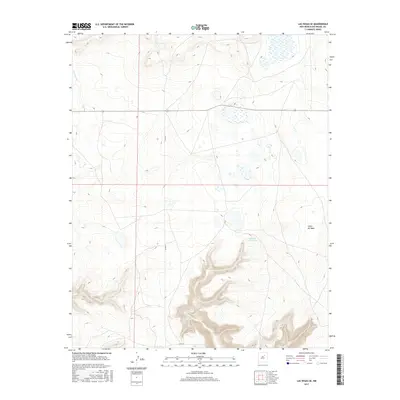
2017 Map of Las Vegas SE
USGS Topo · Published 2017About this map
Rito Vegoso flows through the northwestern portion of this San Miguel County landscape, characterizing the drainage patterns south of Las Vegas. The area is defined by a series of intermittent wetlands and basins that gather across the high plateau. Significant topographical relief appears in the southeast where the Cañon del Agua cuts into the terrain, supported by the Cañon del Agua Spring. Modern transportation is represented by State Road 104 and the north-south corridor of Co Rd 67, providing access to the various ranch lands and natural springs that have historically sustained this arid region of New Mexico.
Find a feature on this map
5 named features on this map. Tap any name to fly to it.
Don’t see what you’re looking for? This feature index may not catch every label — zoom into the map to look around manually.
Map Details
Editions of this 2017 Las Vegas SE Map
This is the sole edition of this map. No revisions or reprints were ever made.
Other maps of this area

1889 · Las Vegas
USGS Topo · 1:125,000

1890 · Bernal
USGS Topo · 1:125,000

1891 · Bernal
USGS Topo · 1:125,000

1891 · Las Vegas
USGS Topo · 1:125,000

1892 · Watrous
USGS Topo · 1:125,000

1892 · Corazon
USGS Topo · 1:125,000

1893 · Las Vegas
USGS Topo · 1:125,000

1894 · Corazon
USGS Topo · 1:125,000

1894 · Watrous
USGS Topo · 1:125,000

1894 · Bernal
USGS Topo · 1:125,000