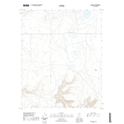
2020 Map of Las Vegas SE
USGS Topo · Published 2020About this map
The high plateau and drainage basins of San Miguel County come into sharp focus in this recent survey. The landscape is dominated by the deeply carved Cañon del Agua in the southeast, a significant landform that dictates the local topography. This arid region relies on intermittent water sources like the Canon del Agua Spring and the Rito Vegoso, which provide critical drainage for the surrounding uplands. The absence of dense settlement reflects the land's use for ranching and open-space management, with transportation limited to routes like Co RD 67 that navigate the high-elevation terrain. This map serves as a clear record of modern New Mexico land use, where natural geography and watershed management remain the primary drivers of human movement across the county.
Find a feature on this map
4 named features on this map. Tap any name to fly to it.
Don’t see what you’re looking for? This feature index may not catch every label — zoom into the map to look around manually.
Map Details
Editions of this 2020 Las Vegas SE Map
This is the sole edition of this map. No revisions or reprints were ever made.
Other maps of this area

1889 · Las Vegas
USGS Topo · 1:125,000

1890 · Bernal
USGS Topo · 1:125,000

1891 · Bernal
USGS Topo · 1:125,000

1891 · Las Vegas
USGS Topo · 1:125,000

1892 · Watrous
USGS Topo · 1:125,000

1892 · Corazon
USGS Topo · 1:125,000

1893 · Las Vegas
USGS Topo · 1:125,000

1894 · Corazon
USGS Topo · 1:125,000

1894 · Watrous
USGS Topo · 1:125,000

1894 · Bernal
USGS Topo · 1:125,000