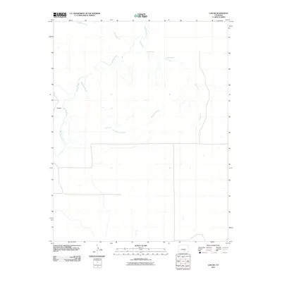
2010 Map of Lascar
USGS Topo · Published 2010About this map
The small settlement of Lascar occupies a high point on the western edge of this Colorado landscape, where the high plains meet the intricate drainage systems of Huerfano County. This 2010 survey highlights a terrain defined by its water sources, both natural and man-made, which have long dictated the patterns of ranching and movement in the region. The Huerfano River carves a path through the western section, while the eastern and northern reaches are dominated by seasonal drainage channels such as Mustang Arroyo, Pine Arroyo, and Rock Spring Arroyo. The presence of Rock Spring and named water points like Ballard Well and Shepard Well indicate the critical importance of reliable water access in this arid environment. The sparse road network and scattered landmarks suggest a quiet, rural continuity that has persisted since the early settlement era.
Find a feature on this map
8 named features on this map. Tap any name to fly to it.
Don’t see what you’re looking for? This feature index may not catch every label — zoom into the map to look around manually.
Map Details
Editions of this 2010 Lascar Map
This is the sole edition of this map. No revisions or reprints were ever made.
Other maps of this area

1891 · Walsenburg
USGS Topo · 1:125,000

1894 · Walsenburg
USGS Topo · 1:125,000

1897 · Walsenburg
USGS Topo · 1:125,000

1900 · Walsenburg
USGS Topo · 1:125,000

1954 · Trinidad
USGS Topo · 1:250,000

1955 · Trinidad
USGS Topo · 1:250,000

1958 · Trinidad
USGS Topo · 1:250,000

1959 · Trinidad
USGS Topo · 1:250,000
1963 · Walsenburg North
USGS Topo · 1:24,000
1963 · Maria Reservoir
USGS Topo · 1:24,000