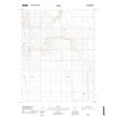
2019 Map of Lascar
USGS Topo · Published 2019About this map
Lascar centers this Colorado landscape where the Huerfano River flows through a series of dramatic arroyos and drainage systems. This 2019 survey documents a sparsely populated ranching region defined by its water management and aviation history, notably the Flying D Ranch Airport in the southeastern quadrant. The presence of the Bradford Canal and various named watercourses like Mustang Arroyo, Pine Arroyo, and Apache Cr underscores the importance of irrigation and natural runoff in this arid environment.
Find a feature on this map
27 named features on this map. Tap any name to fly to it.
Don’t see what you’re looking for? This feature index may not catch every label — zoom into the map to look around manually.
Map Details
Editions of this 2019 Lascar Map
This is the sole edition of this map. No revisions or reprints were ever made.
Other maps of this area

1891 · Walsenburg
USGS Topo · 1:125,000

1894 · Walsenburg
USGS Topo · 1:125,000

1897 · Walsenburg
USGS Topo · 1:125,000

1900 · Walsenburg
USGS Topo · 1:125,000

1954 · Trinidad
USGS Topo · 1:250,000

1955 · Trinidad
USGS Topo · 1:250,000

1958 · Trinidad
USGS Topo · 1:250,000

1959 · Trinidad
USGS Topo · 1:250,000
1963 · Walsenburg North
USGS Topo · 1:24,000
1963 · Maria Reservoir
USGS Topo · 1:24,000