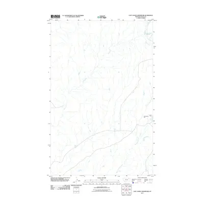
2011 Map of Last Chance Reservoir
USGS Topo · Published 2011About this map
Willow Creek and its many tributaries carve through the expansive grasslands of Valley County, defining the hydrologic character of this high-plains landscape. In the northeastern corner, the Last Chance Reservoir serves as a critical water catchment, a testament to the infrastructure required for ranching and land management in this arid region. The drainage network is further structured by the West Fork Willow Creek, which meanders across the southern sections of the map. Local landmarks like Wild Horse Flat and the Etchart Dam indicate the intersection of the natural terrain with regional land use, where natural depressions and engineered barriers manage the flow of seasonal water. This 2011 survey captures the vast, open character of the Montana prairie, highlighting how subtle shifts in elevation and water availability dictate the layout of this remote landscape.
Find a feature on this map
5 named features on this map. Tap any name to fly to it.
Don’t see what you’re looking for? This feature index may not catch every label — zoom into the map to look around manually.
Map Details
Editions of this 2011 Last Chance Reservoir Map
This is the sole edition of this map. No revisions or reprints were ever made.
Other maps of this area

1919 · Boundary
USGS Topo · 1:125,000

1954 · Glasgow
USGS Topo · 1:250,000

1957 · Glasgow
USGS Topo · 1:250,000

1958 · Glasgow
USGS Topo · 1:250,000

1984 · Lighthouse Hill
USGS Topo · 1:24,000

1984 · Opheim
USGS Topo · 1:100,000

1984 · Gay Dam
USGS Topo · 1:24,000

1984 · Dodge Reservoir
USGS Topo · 1:24,000

1984 · Last Chance Reservoir
USGS Topo · 1:24,000
1984 · Burnett Creek
USGS Topo · 1:24,000