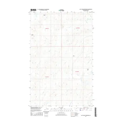
2017 Map of Last Chance Reservoir
USGS Topo · Published 2017About this map
Last Chance Reservoir sits within a landscape defined by deep drainages and dry flats in Valley County. This northern Montana terrain is carved by complex coulee systems, including Chambers Coulee and Starbuck Coulee, which channel seasonal water toward Willow Cr. The map reveals the intricate Public Land Survey System divisions across township lines like T36N R37E and T35N R38E, illustrating how the vast northern plains were gridded for settlement and management. In the eastern reaches of the sheet, the expansive Wild Horse Flat contrasts with the notched topography of Cow Coulee, while the W Fork Willow Cr meanders through the southern sections. This survey provides a precise record of the water management and topographic character of the High Line region in the early twenty-first century.
Find a feature on this map
11 named features on this map. Tap any name to fly to it.
Don’t see what you’re looking for? This feature index may not catch every label — zoom into the map to look around manually.
Map Details
Editions of this 2017 Last Chance Reservoir Map
This is the sole edition of this map. No revisions or reprints were ever made.
Other maps of this area

1919 · Boundary
USGS Topo · 1:125,000

1954 · Glasgow
USGS Topo · 1:250,000

1957 · Glasgow
USGS Topo · 1:250,000

1958 · Glasgow
USGS Topo · 1:250,000

1984 · Lighthouse Hill
USGS Topo · 1:24,000

1984 · Opheim
USGS Topo · 1:100,000

1984 · Gay Dam
USGS Topo · 1:24,000

1984 · Dodge Reservoir
USGS Topo · 1:24,000

1984 · Last Chance Reservoir
USGS Topo · 1:24,000
1984 · Burnett Creek
USGS Topo · 1:24,000