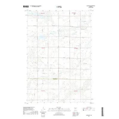
2019 Map of Lastrup NW
USGS Topo · Published 2019About this map
The Nokasippi River and its tributary, the Little Nokasippi River, define the hydraulic character of this landscape along the border of Crow Wing and Morrison Counties. In the north, the Hagen-Arnestad Cem and Riverside Cem serve as quiet touchstones for local family histories. The terrain is a complex patchwork of wetlands and glacial lakes, including Ashenbrenner Lake, Pond Lily Lake, and the expansive Black Brook Swamp in the southeast. While much of the land remains characterized by its natural water features like Mud Lake and Fuchs Lake, a structured grid of rural roads such as Saint Mathias Rd and Sleepy Hollow Rd provides access to the scattered homesteads and agricultural plots that comprise this central Minnesota community.
Find a feature on this map
60 named features on this map. Tap any name to fly to it.
Don’t see what you’re looking for? This feature index may not catch every label — zoom into the map to look around manually.
Map Details
Editions of this 2019 Lastrup NW Map
This is the sole edition of this map. No revisions or reprints were ever made.
Other maps of this area

1915 · Brainerd
USGS Topo · 1:62,500

1916 · Pillager
USGS Topo · 1:62,500

1918 · Brainerd
USGS Topo · 1:62,500

1919 · Pillager
USGS Topo · 1:62,500

1948 · Belle Prairie
USGS Topo · 1:62,500

1948 · Lastrup
USGS Topo · 1:62,500

1950 · Lastrup
USGS Topo · 1:62,500

1950 · Belle Prairie
USGS Topo · 1:62,500

1953 · Brainerd
USGS Topo · 1:250,000

1954 · Baxter
USGS Topo · 1:24,000