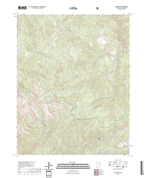
2023 Map of Latir Peak
USGS Topo · Published 2023About this map
The Sangre de Cristo Mountains define the high-altitude landscape of this Taos County survey, where the Latir Peak Wilderness protects a cluster of prominent summits. At the heart of the terrain, Latir Peak and Latir Mesa overlook several alpine basins containing South Latir Lake, Heart Lake, and Baldy Blue Lake. This geography dictates the drainage patterns for the region, with Latir Creek and Cordova Creek flowing through steep canyons toward the lower elevations.
Find a feature on this map
38 named features on this map. Tap any name to fly to it.
Don’t see what you’re looking for? This feature index may not catch every label — zoom into the map to look around manually.
Map Details
Editions of this 2023 Latir Peak Map
This is the sole edition of this map. No revisions or reprints were ever made.
Other maps of this area

1954 · Raton
USGS Topo · 1:250,000

1958 · Raton
USGS Topo · 1:250,000

1963 · Costilla
USGS Topo · 1:24,000

1963 · Amalia
USGS Topo · 1:24,000

1963 · Red River Pass
USGS Topo · 1:24,000

1963 · Cerro
USGS Topo · 1:24,000

1963 · Questa
USGS Topo · 1:24,000

1963 · Latir Peak
USGS Topo · 1:24,000

1963 · Comanche Point
USGS Topo · 1:24,000

1963 · Red River
USGS Topo · 1:24,000