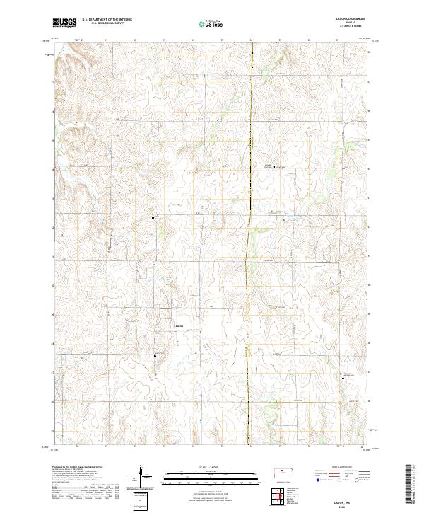
2022 Map of Laton
USGS Topo · Published 2022About this map
The settlement of Laton serves as a focal point in this rural landscape spanning the boundary of Rooks and Osborne counties. The terrain is defined by the drainages of Medicine Cr, Lucky Cr, and Route Cr, which carve through the high plains. A significant landmark, Chalk Mound, rises above the surrounding fields, indicative of the local geology.
Find a feature on this map
39 named features on this map. Tap any name to fly to it.
Don’t see what you’re looking for? This feature index may not catch every label — zoom into the map to look around manually.
Map Details
Editions of this 2022 Laton Map
This is the sole edition of this map. No revisions or reprints were ever made.
Other maps of this area

1896 · Osborne
USGS Topo · 1:125,000

1896 · Plainville
USGS Topo · 1:125,000

1953 · Woodston NW
USGS Topo · 1:24,000

1953 · Woodston
USGS Topo · 1:24,000

1953 · Alton
USGS Topo · 1:24,000

1955 · Beloit
USGS Topo · 1:250,000

1959 · Beloit
USGS Topo · 1:250,000
1978 · Natoma
USGS Topo · 1:24,000
1978 · Paradise NW
USGS Topo · 1:24,000
1978 · Alton SW
USGS Topo · 1:24,000