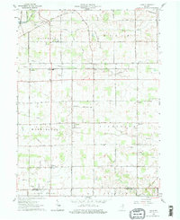
1961 Map of Laud
USGS Topo · Published 1976About this map
The Old Indian Treaty Boundary slices diagonally across the northern landscape of this agricultural region at the junction of Whitley and Huntington counties. Small rail-side hamlets like Peabody, Briggs, and Raber punctuate the route of the New York Chicago and St Louis railroad, which parallels Stony Creek through the center of the survey. The mapping reveals a highly organized township system where rural life revolves around landmarks like the Township Sch and several country houses of worship, including St Catherines Ch and Jefferson Chapel.
Find a feature on this map
29 named features on this map. Tap any name to fly to it.
Don’t see what you’re looking for? This feature index may not catch every label — zoom into the map to look around manually.
Map Details
Editions of this 1961 Laud Map
Other maps of this area

1953 · Fort Wayne
USGS Topo · 1:250,000

1953 · Muncie
USGS Topo · 1:250,000

1955 · Bippus
USGS Topo · 1:24,000

1955 · Columbia City
USGS Topo · 1:24,000

1956 · Muncie
USGS Topo · 1:250,000

1956 · Fort Wayne
USGS Topo · 1:250,000

1956 · Huntington
USGS Topo · 1:24,000

1956 · Lorane
USGS Topo · 1:24,000

1957 · Churubusco
USGS Topo · 1:24,000

1961 · Arcola
USGS Topo · 1:24,000