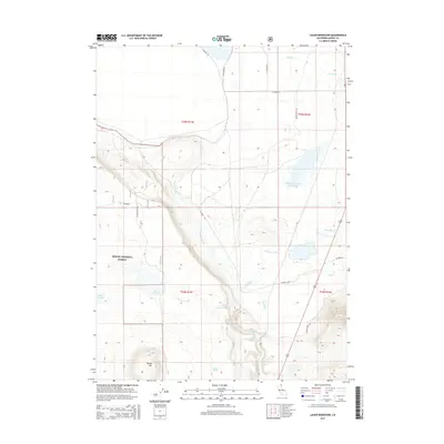
2015 Map of Lauer Reservoir
USGS Topo · Published 2015About this map
The Modoc National Forest landscape defines this corner of northeastern California, where high-altitude water management and natural drainage systems intersect. The terrain is characterized by the descent from N Mountain and Round Mtn toward the watershed of the N Fork Pit River. Man-made and natural hydrology dominate the map, from the primary waters of Lauer Reservoir to the Davis Cr Orchards Reservoir in the north. The presence of Russell Slough and Linnville Creek suggests a seasonal and managed water cycle essential for the region's agricultural and forest lands. A sparse network of forest roads, including Lakeshore Rd and Valley View Rd, provides access to remote points like Bowers Spring and Stock Tank 3, reflecting the area's primary use for ranching and timber management in the early 21st century.
Find a feature on this map
26 named features on this map. Tap any name to fly to it.
Don’t see what you’re looking for? This feature index may not catch every label — zoom into the map to look around manually.
Map Details
Editions of this 2015 Lauer Reservoir Map
This is the sole edition of this map. No revisions or reprints were ever made.
Other maps of this area

1886 · Alturas
USGS Topo · 1:250,000

1892 · Alturas
USGS Topo · 1:250,000

1954 · Alturas
USGS Topo · 1:250,000

1958 · Alturas
USGS Topo · 1:250,000

1962 · Alturas
USGS Topo · 1:250,000

1962 · Davis Creek
USGS Topo · 1:62,500

1962 · Big Sage Reservoir
USGS Topo · 1:62,500

1962 · Willow Ranch
USGS Topo · 1:62,500

1962 · South Mountain
USGS Topo · 1:62,500

1965 · Alturas
USGS Topo · 1:250,000