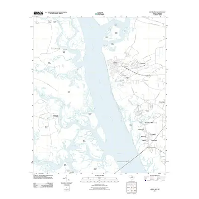
2011 Map of Laurel Bay
USGS Topo · Published 2011About this map
Broad River and its intricate network of tidal creeks and islands define the geography of this Beaufort County landscape. The eastern bank shows significant residential development in communities like Laurel Bay and the Capehart Housing Project, while the western side remains characterized by prominent necks of land such as Boyd Neck and Hazzard Neck. This contrast illustrates the varying uses of the Lowcountry shoreline, from military-related housing to larger rural tracts.
Find a feature on this map
93 named features on this map. Tap any name to fly to it.
Don’t see what you’re looking for? This feature index may not catch every label — zoom into the map to look around manually.
Map Details
Editions of this 2011 Laurel Bay Map
This is the sole edition of this map. No revisions or reprints were ever made.
Other maps of this area

1918 · Green Pond
USGS Topo · 1:62,500

1918 · Yemassee
USGS Topo · 1:62,500

1920 · Okatie
USGS Topo · 1:62,500

1942 · Okatie
USGS Topo · 1:62,500

1943 · Yemassee
USGS Topo · 1:62,500

1943 · Green Pond
USGS Topo · 1:62,500

1944 · Fort Fremont
USGS Topo · 1:62,500

1947 · Savannah
USGS Topo · 1:250,000

1948 · Savannah
USGS Topo · 1:250,000
1956 · Parris Island
USGS Topo · 1:24,000