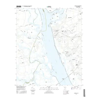
2017 Map of Laurel Bay
USGS Topo · Published 2017About this map
Broad River serves as the central artery of this coastal landscape, dividing the mainland of Beaufort Co from the island-dotted reaches of Jasper Co. The intricate tidal network is defined by numerous necks and islands, including Hogs Neck, Bellinger Neck, and Cotton Island, reflecting a topography deeply tied to the Lowcountry’s water-dominated geography. Small settlements and residential clusters such as Laurel Bay and Burton are situated on the eastern side, while the western side remains more characteristic of maritime forest and marshland near Ridgeland.
Find a feature on this map
117 named features on this map. Tap any name to fly to it.
Don’t see what you’re looking for? This feature index may not catch every label — zoom into the map to look around manually.
Map Details
Editions of this 2017 Laurel Bay Map
This is the sole edition of this map. No revisions or reprints were ever made.
Other maps of this area

1918 · Green Pond
USGS Topo · 1:62,500

1918 · Yemassee
USGS Topo · 1:62,500

1920 · Okatie
USGS Topo · 1:62,500

1942 · Okatie
USGS Topo · 1:62,500

1943 · Yemassee
USGS Topo · 1:62,500

1943 · Green Pond
USGS Topo · 1:62,500

1944 · Fort Fremont
USGS Topo · 1:62,500

1947 · Savannah
USGS Topo · 1:250,000

1948 · Savannah
USGS Topo · 1:250,000
1956 · Parris Island
USGS Topo · 1:24,000