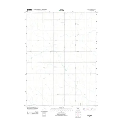
2011 Map of Laurel SE
USGS Topo · Published 2011About this map
The agrarian landscape of Wayne County is defined by a strict grid of section-line roads and the winding paths of intermittent waterways. Dog Creek meanders diagonally across the southern half of the quadrangle, while Dry Creek drains the northeast corner, illustrating the natural drainage patterns of this prairie region. The human geography is represented through a highly organized network of numbered avenues and roads, such as 865th Rd and 571 Ave, which reflect the legacy of the Public Land Survey System. These roads facilitate transport between the dispersed farmsteads characteristic of the area. In the southern portion of the map, the appearance of named residential streets like Highview Dr and E 21st St hints at the northern fringes of more concentrated development.
Find a feature on this map
22 named features on this map. Tap any name to fly to it.
Don’t see what you’re looking for? This feature index may not catch every label — zoom into the map to look around manually.
Map Details
Editions of this 2011 Laurel SE Map
This is the sole edition of this map. No revisions or reprints were ever made.
Other maps of this area

1955 · Sioux City
USGS Topo · 1:250,000

1958 · Sioux City
USGS Topo · 1:250,000

1959 · Sioux City
USGS Topo · 1:250,000

1963 · Winside
USGS Topo · 1:24,000

1963 · Wayne
USGS Topo · 1:24,000

1966 · Altona NW
USGS Topo · 1:24,000

1967 · Wakefield SW
USGS Topo · 1:24,000
1967 · Concord
USGS Topo · 1:24,000
1971 · Laurel
USGS Topo · 1:24,000

1971 · Belden
USGS Topo · 1:24,000