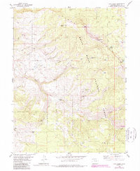
1980 Map of Lava Creek
USGS Topo · Published 1988About this map
The White River Plateau dominates this high-altitude landscape, characterized by steep ridgelines and the headwaters of the Piney River. Surveyed in the mid-1970s and updated with 1980s data, the map details a remote wilderness before the intensification of modern recreation, with access limited to routes like the Crazy Horse Trail and the Castle Trail. The terrain transitions from the broad expanses of the White River National Forest into the protected Eagles Nest Wilderness at its eastern edge.
Find a feature on this map
44 named features on this map. Tap any name to fly to it.
Don’t see what you’re looking for? This feature index may not catch every label — zoom into the map to look around manually.
Map Details
Editions of this 1980 Lava Creek Map
4 editions found
Other maps of this area

1933 · Mt. Powell
USGS Topo · 1:48,000

1934 · Minturn
USGS Topo · 1:62,500

1940 · Mount Powell
USGS Topo · 1:62,500

1950 · Minturn
USGS Topo · 1:62,500

1957 · Leadville
USGS Topo · 1:250,000

1959 · Leadville
USGS Topo · 1:250,000

1960 · Leadville
USGS Topo · 1:250,000

1962 · Leadville
USGS Topo · 1:250,000

1962 · Wolcott
USGS Topo · 1:24,000

1962 · Edwards
USGS Topo · 1:24,000