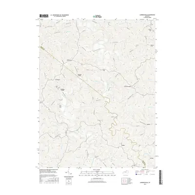
2016 Map of Lawrenceville
USGS Topo · Published 2016About this map
Eagle Creek carves a deep, winding path through the borderlands of Grant and Owen Counties, defining the rural character of this northern Kentucky landscape. The creek's influence is evident in the naming of river crossings like Hensley Ford and Holiday Ford, as well as the positioning of the Starnes Bridge. These points of transit connect a network of small, scattered settlements including Lawrenceville, Holbrook, and Needmore. The terrain is characterized by high ridges such as Simpson Ridge and Chipman Ridge, which dictate the winding routes of roads like Fortner Ridge Rd. For those researching local lineages, the map identifies several smaller burial sites including Mount Hebron Cem, Lingenfelter Cem, and the Gross Cem. The presence of the Mount Pisgah Church and various community nodes like Canby and Keefer reflect a long-standing pattern of dispersed upland agricultural settlement.
Find a feature on this map
77 named features on this map. Tap any name to fly to it.
Don’t see what you’re looking for? This feature index may not catch every label — zoom into the map to look around manually.
Map Details
Editions of this 2016 Lawrenceville Map
This is the sole edition of this map. No revisions or reprints were ever made.
Other maps of this area

1906 · Lockport
USGS Topo · 1:48,000

1908 · Lockport
USGS Topo · 1:62,500

1939 · Sadieville
USGS Topo · 1:62,500

1950 · Mason
USGS Topo · 1:24,000

1950 · Glencoe
USGS Topo · 1:24,000

1950 · Elliston
USGS Topo · 1:24,000

1950 · Williamstown
USGS Topo · 1:24,000

1950 · Owenton
USGS Topo · 1:24,000

1950 · Lawrenceville
USGS Topo · 1:24,000

1953 · Monterey
USGS Topo · 1:24,000