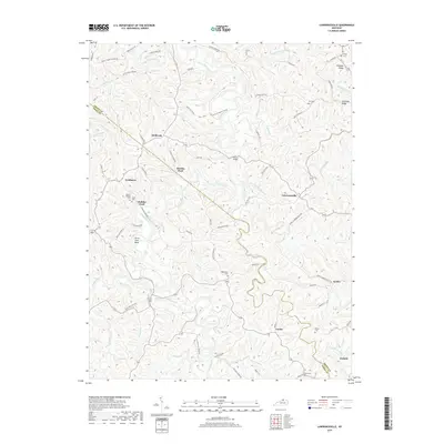
2019 Map of Lawrenceville
USGS Topo · Published 2019About this map
Eagle Creek winds through the borderlands of Grant and Owen counties, carving a deep path through the dissected plateau of northern Kentucky. The landscape is defined by its watercourses, where names like Singer Run, Richland Cr, and Three Forks Creek indicate the complex drainage system feeding the main valley. Small rural nodes such as Needmore, Lawrenceville, and Corinth serve as historical anchors for the region, connected by a network of winding roads like the Old Lusby Mill Pike. Several family and community burial grounds, including Lingenfelter Cem and Mount Hebron Cem, are tucked into the hillsides, providing essential data points for local genealogists. The map also highlights distinctive river features like Horse Shoe Bend and the Elk Riffle, which reflect the localized topography and historic river crossings used before modern infrastructure was established.
Find a feature on this map
75 named features on this map. Tap any name to fly to it.
Don’t see what you’re looking for? This feature index may not catch every label — zoom into the map to look around manually.
Map Details
Editions of this 2019 Lawrenceville Map
This is the sole edition of this map. No revisions or reprints were ever made.
Other maps of this area

1906 · Lockport
USGS Topo · 1:48,000

1908 · Lockport
USGS Topo · 1:62,500

1939 · Sadieville
USGS Topo · 1:62,500

1950 · Mason
USGS Topo · 1:24,000

1950 · Glencoe
USGS Topo · 1:24,000

1950 · Elliston
USGS Topo · 1:24,000

1950 · Williamstown
USGS Topo · 1:24,000

1950 · Owenton
USGS Topo · 1:24,000

1950 · Lawrenceville
USGS Topo · 1:24,000

1953 · Monterey
USGS Topo · 1:24,000