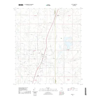
2018 Map of Lawtey
USGS Topo · Published 2018About this map
Lawtey serves as the central hub of this North Florida landscape, where the flatwoods are defined by the prominent elevation of Trail Ridge. This geologic feature dictates the drainage patterns for numerous local waterways, including Alligator Cr and Olustee Cr, which meander through the western timberlands and wetlands. The settlement pattern follows the north-south transit corridor, connecting Highland in the north to the community of Saxton in the south. Local history is anchored by landmarks such as the Lawtey Cem and the local Po, while a dense network of county roads like NW Co RD 125 and Middleburg Rd provide access to the rural homesteads and agricultural tracts that characterize the Bradford and Clay County borderlands.
Find a feature on this map
53 named features on this map. Tap any name to fly to it.
Don’t see what you’re looking for? This feature index may not catch every label — zoom into the map to look around manually.
Map Details
Editions of this 2018 Lawtey Map
This is the sole edition of this map. No revisions or reprints were ever made.
Other maps of this area

1918 · Middleburg
USGS Topo · 1:62,500

1918 · Lawtey
USGS Topo · 1:62,500

1941 · Starke
USGS Topo · 1:62,500

1941 · Middleburg
USGS Topo · 1:62,500

1942 · Ates Creek
USGS Topo · 1:62,500

1948 · Starke
USGS Topo · 1:50,000

1948 · Jacksonville
USGS Topo · 1:250,000

1949 · Middleburg SW
USGS Topo · 1:24,000

1949 · Sampson
USGS Topo · 1:24,000

1949 · Fiftone
USGS Topo · 1:24,000