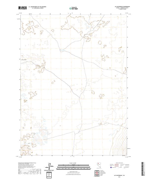
2021 Map of Lay Waterhole
USGS Topo · Published 2021About this map
Lay Waterhole provides a vital point of interest in this expansive stretch of Desert Valley in Humboldt County. This area is characterized by the structured grid of the Public Land Survey System, including townships t38n r33e, t37n r34e, and t36n r33e, which organize the remote high-desert terrain. The landscape is defined by its sparse hydrography and a network of unimproved roads that trace the natural contours and section lines of the basin. Researchers and historians can observe the minimal but essential human imprint on this land, where water sources like the waterhole were historically critical for survival and navigation in the Great Basin region.
Find a feature on this map
8 named features on this map. Tap any name to fly to it.
Don’t see what you’re looking for? This feature index may not catch every label — zoom into the map to look around manually.
Map Details
Editions of this 2021 Lay Waterhole Map
This is the sole edition of this map. No revisions or reprints were ever made.
Other maps of this area

1886 · Disaster
USGS Topo · 1:250,000

1893 · Disaster
USGS Topo · 1:250,000

1931 · Lovelock
USGS Topo · 1:250,000

1935 · Lovelock
USGS Topo · 1:250,000

1954 · Vya
USGS Topo · 1:250,000

1955 · Lovelock
USGS Topo · 1:250,000

1958 · Vya
USGS Topo · 1:250,000

1959 · Lovelock
USGS Topo · 1:250,000

1962 · Vya
USGS Topo · 1:250,000

1966 · Donna Schee Peak
USGS Topo · 1:62,500