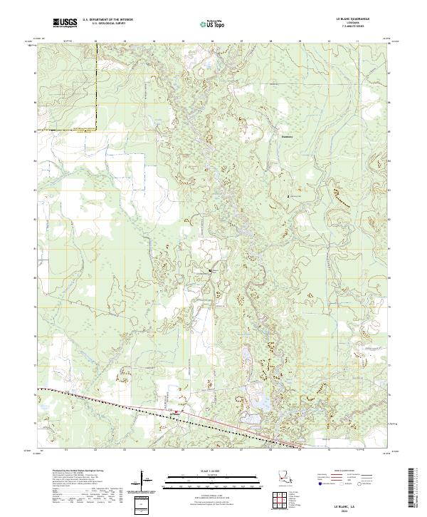
2024 Map of Le Blanc
USGS Topo · Published 2024About this map
The Culcasieu River and its intricate network of tributaries define this landscape along the border of Beauregard Parish and Allen Parish. Small communities like Harmony and Le Blanc anchor the region, which is characterized by a mix of wetlands and rural tracts. Local history is preserved at the Leblanc Cem and Harmony Cem, while water management is evident in the presence of the Harmony Canal. The terrain is dominated by water bodies such as Crosby Lake, Red Bluff Lake, and Black Lake, connected by winding waterways like Whisky Chitto Creek and Bunchs Creek. An extensive local road system, including Methodist Camp Rd and Carpenters Bridge Rd, provides access to these low-lying areas, illustrating the long-standing human adaptation to the riverine environment.
Find a feature on this map
42 named features on this map. Tap any name to fly to it.
Don’t see what you’re looking for? This feature index may not catch every label — zoom into the map to look around manually.
Map Details
Editions of this 2024 Le Blanc Map
This is the sole edition of this map. No revisions or reprints were ever made.
Other maps of this area

1935 · Mittie
USGS Topo · 1:31,680

1947 · Kinder
USGS Topo · 1:31,680

1947 · Oberlin
USGS Topo · 1:31,680

1947 · Pine Chapel
USGS Topo · 1:31,680

1947 · Le Blanc
USGS Topo · 1:31,680

1947 · Edna
USGS Topo · 1:31,680

1947 · Reeves
USGS Topo · 1:31,680

1947 · Thompson Bluff
USGS Topo · 1:31,680

1947 · Bundick
USGS Topo · 1:31,680
1948 · Mittie
USGS Topo · 1:24,000