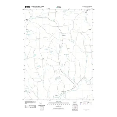
2010 Map of Le Raysville
USGS Topo · Published 2010About this map
Le Raysville serves as the central hub for this corner of Susquehanna County, where agricultural lands are defined by the winding paths of Wyalusing Creek and Rockwell Creek. The landscape is a network of small crossroads and family-named landmarks, ranging from Chaffee Corners in the north to Stevensville at the southern edge. Numerous small ponds and reservoirs, such as Bert Jayne Pond and Leisure Lakes, dot the terrain, reflecting the region's hydrography and recreation patterns.
Find a feature on this map
71 named features on this map. Tap any name to fly to it.
Don’t see what you’re looking for? This feature index may not catch every label — zoom into the map to look around manually.
Map Details
Editions of this 2010 Le Raysville Map
This is the sole edition of this map. No revisions or reprints were ever made.
Other maps of this area

1923 · Towanda
USGS Topo · 1:62,500

1926 · Towanda
USGS Topo · 1:62,500

1943 · Towanda
USGS Topo · 1:62,500

1943 · Monroeton
USGS Topo · 1:62,500

1943 · Le Raysville
USGS Topo · 1:62,500

1945 · Le Raysville
USGS Topo · 1:62,500

1945 · Meshoppen
USGS Topo · 1:62,500

1945 · Auburn Center
USGS Topo · 1:24,000

1945 · Laceyville
USGS Topo · 1:24,000
1947 · Auburn Center
USGS Topo · 1:31,680