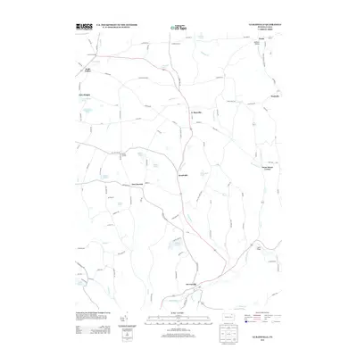
2013 Map of Le Raysville
USGS Topo · Published 2013About this map
Le Raysville serves as the primary hub of this landscape, situated at a junction of roads that branch out toward smaller rural hamlets like Brushville and East Herrick. The terrain is defined by a dense network of streams and small ponds, including Rockwell Cr and Wyalusing Cr, which carved the valleys where many of these communities were established. The presence of Giffin Airport near the southeastern corner of the map indicates a modernized infrastructure supporting this rural corner of Pennsylvania.
Find a feature on this map
117 named features on this map. Tap any name to fly to it.
Don’t see what you’re looking for? This feature index may not catch every label — zoom into the map to look around manually.
Map Details
Editions of this 2013 Le Raysville Map
This is the sole edition of this map. No revisions or reprints were ever made.
Other maps of this area

1923 · Towanda
USGS Topo · 1:62,500

1926 · Towanda
USGS Topo · 1:62,500

1943 · Towanda
USGS Topo · 1:62,500

1943 · Monroeton
USGS Topo · 1:62,500

1943 · Le Raysville
USGS Topo · 1:62,500

1945 · Le Raysville
USGS Topo · 1:62,500

1945 · Meshoppen
USGS Topo · 1:62,500

1945 · Auburn Center
USGS Topo · 1:24,000

1945 · Laceyville
USGS Topo · 1:24,000
1947 · Auburn Center
USGS Topo · 1:31,680