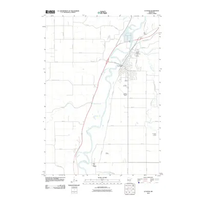
2010 Map of Le Sueur
USGS Topo · Published 2010About this map
Le Sueur and the smaller settlement of Ottawa are the primary focal points of this 2010 survey, which highlights the valley where the Minnesota River snakes through the landscape. The geography is defined by a dense network of watercourses, including Le Sueur Creek, Forest Prairie Creek, and Cherry Creek, which have shaped the local agricultural and civil layout. Notable for local history and genealogy, the map identifies several distinct burial grounds such as Mound Cemetery and Calvary Cemetery in the north, and Ottawa Cemetery to the south. Modern infrastructure like the Le Sueur Municipal Airport and the Le Sueur Erosion Project Dam indicate the town's growth and the ongoing management of the river environment. The road grid reflects both rural development and historical river access, with named routes like Railroad St and Ottawa Rd connecting the riverside communities.
Find a feature on this map
44 named features on this map. Tap any name to fly to it.
Don’t see what you’re looking for? This feature index may not catch every label — zoom into the map to look around manually.
Map Details
Editions of this 2010 Le Sueur Map
This is the sole edition of this map. No revisions or reprints were ever made.
Other maps of this area

1953 · Saint Paul
USGS Topo · 1:250,000

1953 · New Ulm
USGS Topo · 1:250,000

1957 · New Ulm
USGS Topo · 1:250,000

1957 · Belle Plaine
USGS Topo · 1:62,500

1958 · New Ulm
USGS Topo · 1:250,000

1958 · Gaylord
USGS Topo · 1:62,500

1959 · Saint Paul
USGS Topo · 1:250,000

1965 · Cleveland
USGS Topo · 1:24,000

1965 · Norseland
USGS Topo · 1:24,000

1965 · North Star
USGS Topo · 1:24,000