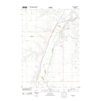
2013 Map of Le Sueur
USGS Topo · Published 2013About this map
The Minnesota River carves a deep valley through this region of southern Minnesota, creating a natural border between Sibley, Nicollet, and Le Sueur counties. The city of Le Sueur sits prominently on the eastern terrace of the river, where a network of local streets like Railroad St and N Main St meet transportation corridors such as Us-169. Further south along the riverbank, the smaller settlement of Ottawa remains a distinct point of interest. Several tributaries, including Rush River, Barney Fry Cr, and Le Sueur Cr, drain the surrounding agricultural uplands into the main river channel. Local history and genealogy are well-represented by a concentration of burial grounds, from the Saint Annes Cem in the north to the Evangelical Church Cem and Ottawa Cem in the south, while the Le Sueur Municipal Airport reflects more contemporary local infrastructure.
Find a feature on this map
63 named features on this map. Tap any name to fly to it.
Don’t see what you’re looking for? This feature index may not catch every label — zoom into the map to look around manually.
Map Details
Editions of this 2013 Le Sueur Map
This is the sole edition of this map. No revisions or reprints were ever made.
Other maps of this area

1953 · Saint Paul
USGS Topo · 1:250,000

1953 · New Ulm
USGS Topo · 1:250,000

1957 · New Ulm
USGS Topo · 1:250,000

1957 · Belle Plaine
USGS Topo · 1:62,500

1958 · New Ulm
USGS Topo · 1:250,000

1958 · Gaylord
USGS Topo · 1:62,500

1959 · Saint Paul
USGS Topo · 1:250,000

1965 · Cleveland
USGS Topo · 1:24,000

1965 · Norseland
USGS Topo · 1:24,000

1965 · North Star
USGS Topo · 1:24,000