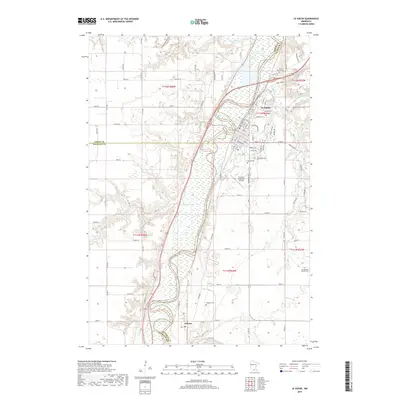
2019 Map of Le Sueur
USGS Topo · Published 2019About this map
The Minnesota River carves a wide, wetland-rich valley through this region, forming a natural border between Sibley, Nicollet, and Le Sueur counties. On the eastern bluffs, the city of Le Sueur serves as the primary population center, its grid extending toward the river's edge near the junction with Le Sueur Cr. The landscape is defined by the transition from upland agricultural plains to the carved river bottoms, where numerous small tributaries like Barney Fry Cr and Cherry Cr descend to the valley floor. To the south, the smaller settlement of Ottawa sits tucked against the bend of the river, surrounded by several family and community burial grounds including Ottawa Cem. This survey illustrates the intricate balance of modern infrastructure, such as the Le Sueur Municipal Airport, against the perennial flooding patterns of the river valley, evidenced by the extensive marshlands along the water's course.
Find a feature on this map
98 named features on this map. Tap any name to fly to it.
Don’t see what you’re looking for? This feature index may not catch every label — zoom into the map to look around manually.
Map Details
Editions of this 2019 Le Sueur Map
This is the sole edition of this map. No revisions or reprints were ever made.
Other maps of this area

1953 · Saint Paul
USGS Topo · 1:250,000

1953 · New Ulm
USGS Topo · 1:250,000

1957 · New Ulm
USGS Topo · 1:250,000

1957 · Belle Plaine
USGS Topo · 1:62,500

1958 · New Ulm
USGS Topo · 1:250,000

1958 · Gaylord
USGS Topo · 1:62,500

1959 · Saint Paul
USGS Topo · 1:250,000

1965 · Cleveland
USGS Topo · 1:24,000

1965 · Norseland
USGS Topo · 1:24,000

1965 · North Star
USGS Topo · 1:24,000