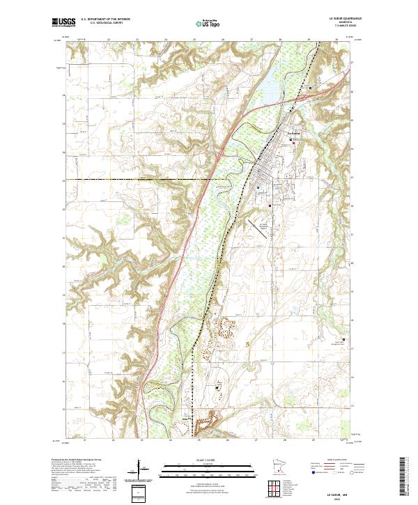
2022 Map of Le Sueur
USGS Topo · Published 2022About this map
The Minnesota River carves a deep valley through this portion of the Minnesota River Valley, defining the local geography as it flows past Le Sueur and the small settlement of Ottawa. The river's winding course is paralleled by the Union Pacific RR, a corridor that historically shaped the growth of these riverside communities. To the west, the landscape rises into the Riverview Hills, while numerous smaller waterways such as Rush River, Barney Fry Cr, and Cherry Cr drain into the primary valley.
Find a feature on this map
101 named features on this map. Tap any name to fly to it.
Don’t see what you’re looking for? This feature index may not catch every label — zoom into the map to look around manually.
Map Details
Editions of this 2022 Le Sueur Map
This is the sole edition of this map. No revisions or reprints were ever made.