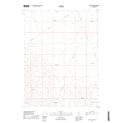
2018 Map of Leach Hot Springs
USGS Topo · Published 2018About this map
Nelson Hot Spring and Leach Hot Springs define the hydrogeological character of this high-desert basin in the years before 2018. Located in the transition between the basin floor of Grass Valley and the rising slopes of the East Range, these geothermal features are connected by a sparse network of gravel and dirt tracks. The naming of Quicksilver Mines Rd serves as a reminder of the region's mercury-mining history, cutting across the foothills of the Goldbanks Hills in the southern portion of the quadrangle. In the far southwest, the steep ascent to Table Mtn marks the rugged transition from valley floor to high-elevation plateau. The land is largely defined by its public land survey system grid, with sections of Township 31 and 32 North clearly demarcated across the drainage patterns of Spaulding Canyon Rd.
Find a feature on this map
15 named features on this map. Tap any name to fly to it.
Don’t see what you’re looking for? This feature index may not catch every label — zoom into the map to look around manually.
Map Details
Editions of this 2018 Leach Hot Springs Map
This is the sole edition of this map. No revisions or reprints were ever made.
Other maps of this area

1932 · Sonoma Range
USGS Topo · 1:250,000

1939 · Sonoma Range
USGS Topo · 1:250,000

1955 · Winnemucca
USGS Topo · 1:250,000

1958 · Winnemucca
USGS Topo · 1:250,000
1961 · Kyle Hot Springs
USGS Topo · 1:62,500

1961 · Mt. Tobin
USGS Topo · 1:62,500

1961 · Leach Hot Springs
USGS Topo · 1:62,500

1961 · Dun Glen
USGS Topo · 1:62,500

1962 · Winnemucca
USGS Topo · 1:250,000

1982 · Fish Creek Mts
USGS Topo · 1:100,000