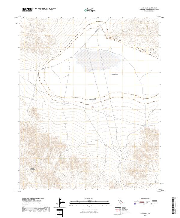
2021 Map of Leach Lake
USGS Topo · Published 2021About this map
Leach Lake sits at the heart of this high-desert landscape in San Bernardino County, where the dry lake bed serves as a focal point for the surrounding topography. The terrain is defined by the convergence of several major landforms, including the Quail Mountains to the northwest and the Granite Mountains to the southwest, framing the northern reaches of the Mojave Desert. This area represents a critical intersection of arid basins and steep elevations, providing a clear record of the natural hydrology that sustains life in the desert.
Find a feature on this map
13 named features on this map. Tap any name to fly to it.
Don’t see what you’re looking for? This feature index may not catch every label — zoom into the map to look around manually.
Map Details
Editions of this 2021 Leach Lake Map
This is the sole edition of this map. No revisions or reprints were ever made.
Other maps of this area

1933 · Avawatz Mountains
USGS Topo · 1:250,000

1947 · Trona
USGS Topo · 1:250,000

1948 · Trona
USGS Topo · 1:250,000

1948 · Quail Mountains
USGS Topo · 1:62,500

1948 · Leach Lake
USGS Topo · 1:62,500

1948 · Goldstone Lake
USGS Topo · 1:62,500

1948 · Tiefort Mountains
USGS Topo · 1:62,500

1951 · Goldstone Lake
USGS Topo · 1:62,500

1951 · Tiefort Mountains
USGS Topo · 1:62,500

1951 · Quail Mountains
USGS Topo · 1:62,500