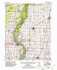
1956 Map of Leachville
USGS Topo · Published 1975About this map
The St Francis River and its intricate network of drainage ditches dominate this mid-century landscape in the Arkansas Sunken Lands. During this era, the region was heavily shaped by flood control efforts, seen in the vast systems of Ditch No 1 through Ditch No 11 that crisscross the agricultural plains of Mississippi, Craighead, and Greene counties. Small agricultural hubs like Monette, Black Oak, and Leachville serve as central points for the surrounding rural communities, many of which are linked by the St Louis Southwestern RR and the St Louis San Francisco RR. Notable landmarks of local heritage include the Indian Mounds near Schugtown and a series of island-named terrain features such as Gum Island and Big Island, reflecting the area's complex alluvial geography before modern land reclamation fully transformed the delta.
Find a feature on this map
93 named features on this map. Tap any name to fly to it.
Don’t see what you’re looking for? This feature index may not catch every label — zoom into the map to look around manually.
Map Details
Editions of this 1956 Leachville Map
2 editions found

Other maps of this area

1934 · Kennett
USGS Topo · 1:62,500

1939 · Jonesboro
USGS Topo · 1:62,500

1939 · Evadale
USGS Topo · 1:62,500

1940 · Dee
USGS Topo · 1:62,500

1940 · Gainesville
USGS Topo · 1:62,500

1940 · Marmaduke
USGS Topo · 1:62,500

1940 · Kennett
USGS Topo · 1:62,500

1941 · Leachville
USGS Topo · 1:62,500

1941 · Manila
USGS Topo · 1:62,500

1941 · Marked Tree
USGS Topo · 1:62,500