
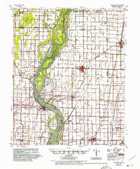
1956 Map of Leachville
USGS Topo · Published 1956About this map
The St Francis River bottomlands define this mid-century landscape, where the Sunk Lands and Big Cypress Swamp still dictate the pattern of human settlement. The 1950s era of agriculture is visible in the dense network of drainage channels like Big Bay Ditch and Honey Cypress Ditch, which converted these wetlands into productive acreage. Small agricultural hubs such as Leachville, Monette, and Lake City anchor the region, connected by the St Louis Southwestern RR and St Louis San Francisco RR.
Find a feature on this map
91 named features on this map. Tap any name to fly to it.
Don’t see what you’re looking for? This feature index may not catch every label — zoom into the map to look around manually.
Map Details
Editions of this 1956 Leachville Map
2 editions found
Other maps of this area

1934 · Kennett
USGS Topo · 1:62,500

1939 · Jonesboro
USGS Topo · 1:62,500

1939 · Evadale
USGS Topo · 1:62,500

1940 · Dee
USGS Topo · 1:62,500

1940 · Gainesville
USGS Topo · 1:62,500

1940 · Marmaduke
USGS Topo · 1:62,500

1940 · Kennett
USGS Topo · 1:62,500

1941 · Leachville
USGS Topo · 1:62,500

1941 · Manila
USGS Topo · 1:62,500

1941 · Marked Tree
USGS Topo · 1:62,500