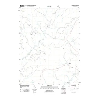
2011 Map of Lead Mine
USGS Topo · Published 2011About this map
Lead Mine and Shafer occupy a landscape defined by the intricate drainages of Horseshoe Run and Leadmine Run in this 2011 survey. The settlement patterns in the southern portion of the quadrangle reflect the industrial history of the Blackwater River area, where Coketon, Douglas, and Benbush are situated. These locales were historically central to the region's coal and coke production, and the presence of Fairfax Quarry further underscores the legacy of resource extraction.
Find a feature on this map
55 named features on this map. Tap any name to fly to it.
Don’t see what you’re looking for? This feature index may not catch every label — zoom into the map to look around manually.
Map Details
Editions of this 2011 Lead Mine Map
This is the sole edition of this map. No revisions or reprints were ever made.
Other maps of this area

1886 · St. George
USGS Topo · 1:125,000

1891 · St. George
USGS Topo · 1:125,000

1895 · Piedmont
USGS Topo · 1:125,000

1899 · Oakland
USGS Topo · 1:62,500

1900 · Oakland
USGS Topo · 1:62,500

1907 · Kingwood
USGS Topo · 1:62,500

1908 · Parsons
USGS Topo · 1:62,500

1916 · Davis
USGS Topo · 1:48,000

1918 · Davis
USGS Topo · 1:62,500

1919 · Davis
USGS Topo · 1:62,500