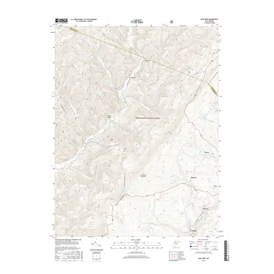
2016 Map of Lead Mine
USGS Topo · Published 2016About this map
Lead Mine and the surrounding high-country settlements of Pierce, Benbush, and Coketon occupy this rugged portion of the Monongahela National Forest. The landscape is defined by its deep drainage basins, where Horseshoe Run and the North Fork Blackwater River carve through the terrain near the Preston and Tucker County line. Long-standing family and community connections are preserved in the locations of Rose Hill Cem, Kight Cem, and Knotts Cem, which dot the ridges near Shafer and Douglas. High-elevation landmarks such as Backbone Mountain and Close Mtn rise above a network of forest trails, including the Allegheny Trail and McKinley Run Trail. This documentation provides a clear view of the rural crossroads and mountain geography that have shaped this pocket of West Virginia.
Find a feature on this map
48 named features on this map. Tap any name to fly to it.
Don’t see what you’re looking for? This feature index may not catch every label — zoom into the map to look around manually.
Map Details
Editions of this 2016 Lead Mine Map
This is the sole edition of this map. No revisions or reprints were ever made.
Other maps of this area

1886 · St. George
USGS Topo · 1:125,000

1891 · St. George
USGS Topo · 1:125,000

1895 · Piedmont
USGS Topo · 1:125,000

1899 · Oakland
USGS Topo · 1:62,500

1900 · Oakland
USGS Topo · 1:62,500

1907 · Kingwood
USGS Topo · 1:62,500

1908 · Parsons
USGS Topo · 1:62,500

1916 · Davis
USGS Topo · 1:48,000

1918 · Davis
USGS Topo · 1:62,500

1919 · Davis
USGS Topo · 1:62,500