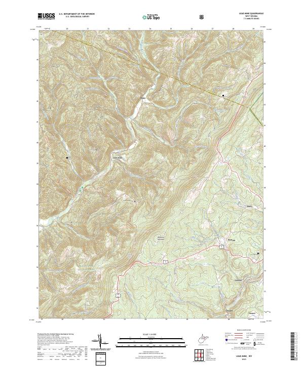
2023 Map of Lead Mine
USGS Topo · Published 2023About this map
Lead Mine and Shafer occupy the northern reaches of this West Virginia landscape, where the Preston Co and Tucker Co line divides the high ridges. This area is defined by its industrial and burial history, with family landmarks like the Knotts Family Cem and Kight Cem situated among the headwaters of Horseshoe Run. To the south, the terrain rises sharply toward Backbone Mountain and Close Mtn, forming a massive natural barrier above the deep valleys of the Monongahela National Forest.
Find a feature on this map
49 named features on this map. Tap any name to fly to it.
Don’t see what you’re looking for? This feature index may not catch every label — zoom into the map to look around manually.
Map Details
Editions of this 2023 Lead Mine Map
This is the sole edition of this map. No revisions or reprints were ever made.
Other maps of this area

1886 · St. George
USGS Topo · 1:125,000

1891 · St. George
USGS Topo · 1:125,000

1895 · Piedmont
USGS Topo · 1:125,000

1899 · Oakland
USGS Topo · 1:62,500

1900 · Oakland
USGS Topo · 1:62,500

1907 · Kingwood
USGS Topo · 1:62,500

1908 · Parsons
USGS Topo · 1:62,500

1916 · Davis
USGS Topo · 1:48,000

1918 · Davis
USGS Topo · 1:62,500

1919 · Davis
USGS Topo · 1:62,500