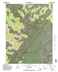
1995 Map of Lead Mine
USGS Topo · Published 1998About this map
Leadmine Mountain and the high ridges of Backbone Mountain dominate this corner of the Monongahela National Forest, where deep valleys and industrial operations define the landscape. The map details the transition from the forested heights of St George to the coal-heavy topography near Thomas and Coketon. Numerous strip mines and an identified Historic Industrial Site near Douglas indicate the intense extractive history of the region.
Find a feature on this map
71 named features on this map. Tap any name to fly to it.
Don’t see what you’re looking for? This feature index may not catch every label — zoom into the map to look around manually.
Map Details
Editions of this 1995 Lead Mine Map
This is the sole edition of this map. No revisions or reprints were ever made.
Other maps of this area

1886 · St. George
USGS Topo · 1:125,000

1891 · St. George
USGS Topo · 1:125,000

1895 · Piedmont
USGS Topo · 1:125,000

1899 · Oakland
USGS Topo · 1:62,500

1900 · Oakland
USGS Topo · 1:62,500

1907 · Kingwood
USGS Topo · 1:62,500

1908 · Parsons
USGS Topo · 1:62,500

1916 · Davis
USGS Topo · 1:48,000

1918 · Davis
USGS Topo · 1:62,500

1919 · Davis
USGS Topo · 1:62,500