
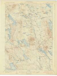
1932 Map of Lead Mountain
USGS Topo · Published 1932About this map
Lead Mountain and its summit Fire Tower command the center of this Maine landscape, where the Air Line Road cuts through the timberlands of Hancock and Washington Counties. In the early 1930s, the region was defined by a network of logging camps and rural outposts, such as Howe Farm Camp, Farnsworth Camp, and Jacobs Camp. The settlements of Deblois and Beddington serve as the primary hubs, situated near the winding Narraguagus River. Water-level control is evident at Hemlock Dam, which regulated the flow for downstream industry or log drives. From the ridge lines like Blackcap Mountain and Gould Ridge down to remote water bodies like Alligator Lake, the topography reveals a terrain managed for its natural resources and accessible via landings like Steep Landing on the West Branch.
Find a feature on this map
105 named features on this map. Tap any name to fly to it.
Don’t see what you’re looking for? This feature index may not catch every label — zoom into the map to look around manually.
Map Details
Editions of this 1932 Lead Mountain Map
5 editions found
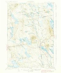

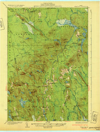
Other maps of this area

1902 · Cherryfield
USGS Topo · 1:62,500

1904 · Cherryfield
USGS Topo · 1:62,500

1911 · Ellsworth
USGS Topo · 1:62,500

1929 · Great Pond
USGS Topo · 1:48,000

1929 · Lead Mountain
USGS Topo · 1:48,000

1930 · Tunk Lake
USGS Topo · 1:48,000

1931 · Saponac
USGS Topo · 1:48,000

1932 · Tunk Lake
USGS Topo · 1:62,500

1932 · Nicatous Lake
USGS Topo · 1:48,000
1932 · Great Pond
USGS Topo · 1:62,500