1932 Map of Lead Mountain
USGS Topo · Published 1945About this map
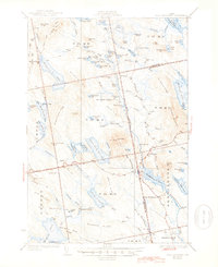
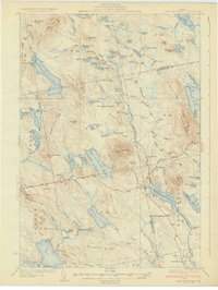
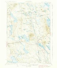
Beddington and Deblois serve as the primary human outposts in this landscape of the Downeast interior, surveyed in the late 1920s. The region is defined by a dense network of water bodies and timber-related camps, including Howe Farm Camp and Farnsworth Camp, linked by early roads and the Narraguagus River. The prominent Lead Mtn, topped with a Fire Tower, anchors the central terrain, overlooking a complex system of glacial features like Gould Ridge and Smith Ridge.
Find a feature on this map
113 named features on this map. Tap any name to fly to it.
Don’t see what you’re looking for? This feature index may not catch every label — zoom into the map to look around manually.
Map Details
Editions of this 1932 Lead Mountain Map
5 editions found

Other maps of this area

1902 · Cherryfield
USGS Topo · 1:62,500

1904 · Cherryfield
USGS Topo · 1:62,500

1911 · Ellsworth
USGS Topo · 1:62,500

1929 · Great Pond
USGS Topo · 1:48,000

1929 · Lead Mountain
USGS Topo · 1:48,000

1930 · Tunk Lake
USGS Topo · 1:48,000

1931 · Saponac
USGS Topo · 1:48,000

1932 · Tunk Lake
USGS Topo · 1:62,500

1932 · Nicatous Lake
USGS Topo · 1:48,000

1932 · Lead Mountain
USGS Topo · 1:62,500