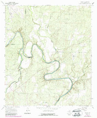
1967 Map of Leaday
USGS Topo · Published 1988About this map
The Colorado River meanders through the heart of this Central Texas landscape, defining the jagged boundaries where Runnels, Coleman, and Concho Counties meet. In the late 1960s, the small settlement of Leaday served as a local hub, situated near the confluence of Grape Creek and the main river channel. The topography is marked by significant drainages such as Little Grape Creek and Wheeler Branch, while the prominent Brushy Bluff overlooks the river's western bends.
Find a feature on this map
20 named features on this map. Tap any name to fly to it.
Don’t see what you’re looking for? This feature index may not catch every label — zoom into the map to look around manually.
Map Details
Editions of this 1967 Leaday Map
2 editions found

Other maps of this area

1892 · Eden
USGS Topo · 1:125,000

1892 · Ballinger
USGS Topo · 1:125,000

1896 · Eden
USGS Topo · 1:125,000

1924 · Eden 1-a
USGS Topo · 1:48,000

1925 · Ballinger 3-d
USGS Topo · 1:48,000

1925 · Ballinger 4-c
USGS Topo · 1:48,000

1931 · Stacy
USGS Topo · 1:62,500

1932 · Voss
USGS Topo · 1:62,500

1932 · Paint Rock
USGS Topo · 1:62,500

1954 · Brownwood
USGS Topo · 1:250,000